Canarias.app travel guide · Tenerife
Punta de Teno, Tenerife: lighthouse, cliffs and regulated access
Punta de Teno is the western tip of Tenerife, in Buenavista del Norte, with a lighthouse, rock pools, a small cove and open views towards Los Gigantes. Car access is restricted for part of the time for safety and conservation reasons, so check the current regulations before going. Access on foot is free when conditions allow, but the setting demands caution because of rockfalls, wind and swell.
What it is and why visit
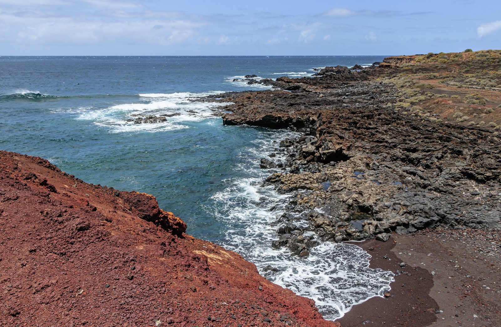
Punta de Teno is one of Tenerife's most spectacular road-end landscapes: a volcanic point open to the Atlantic, with a lighthouse, cliffs, rock pools, a small cove and views towards the wall of Los Gigantes. It lies in Buenavista del Norte, within the Teno massif area, and has a strong sense of being at the edge of the island. This is not an easy beach or an urban viewpoint; it is a place to study the relief, feel the force of western Tenerife and accept that access is regulated for good reasons.
The lighthouse, cove and views
The classic image of Punta de Teno brings together the lighthouse, volcanic rock and open sea, with Los Gigantes cut into the southeast horizon. On clear days, La Gomera and La Palma may also be visible. The area has rock pools and a small cove, but swimming should not be the only reason to come: the sea can change quickly and waves hit hard along the edges. Sunset is often one of the most sought-after moments, thanks to the side light on the cliffs and the feeling of reaching the island's end.
Regulated access
Car access to Punta de Teno is restricted for part of the time due to safety, conservation and the risk of rockfalls on the road. The usual alternative is the shuttle bus from Buenavista del Norte, as well as taxi, bicycle or walking access when conditions and regulations allow. Before setting off, check the current rules through official channels: restriction times, departure points, weather-related closures or incidents, and any seasonal changes. Do not force access or park where it is not permitted.
How to fit it into a route
Punta de Teno works very well as part of a route through north-west Tenerife: Buenavista del Norte, Garachico, the Teno massif and, if you have time, Masca. Do not try to fit too many stops into one afternoon if you depend on the shuttle bus or mountain roads. The visit needs margin for changes in access, wind, light and the return journey. If you are coming from the tourist south, calculate the full route: the west of the island is best enjoyed without watching the clock.
Tips for visiting
Take water, sun protection, something warm for the wind and shoes with good grip on rock. Do not go near exposed edges or wave-washed areas for photos. If you go at sunset, plan the return before dark and confirm transport. On hot days it may look like an easy outing, but Punta de Teno remains an exposed natural area, with a sensitive road and changing conditions. The best visit is one that respects the regulations and leaves no trace.
The walk
Despejado
Live weather at Teno Alto. The massif plunges straight into the sea and the trade wind hits hard on the ridge: check the gusts before setting off.
Indicative route based on official mapping and the main waypoints; it is not a substitute for a GPS track or on-site waymarking.
Teno Alto
From the hamlet of Teno Alto you head west on the PR-TF 51, between stone walls and goat pastures, with Mount Teide rising behind you.
The Teno ridge
The path runs along the spine of the massif, the sea opening on both sides and, on clear days, the Anaga sea-stacks outlined in the distance.
Lighthouse road
The trail meets the lighthouse road by the Itobal bus stop; from here the final stretch out to the point is covered on bus 369.
Punta de Teno
The lighthouse, the rock pools and the small cove mark the westernmost tip of Tenerife, with the Los Gigantes cliffs closing the horizon to the south.
The walking section drops from Teno Alto to the lighthouse road, about 4 km. The final 2.2 km to the point is road closed to pedestrians: take bus 369 from Buenavista del Norte.
FAQ
Questions about Punta de Teno, Tenerife
Can you drive to Punta de Teno?
Car access is restricted for part of the time. Before going, check the current regulations and available alternatives, such as the shuttle bus from Buenavista, taxi, bicycle or walking access if permitted.
Is Punta de Teno free?
The natural area is free to access when conditions allow. What may cost money is the transport you choose to get there, such as bus, taxi or excursion, always depending on the current regulations.
What can you see from Punta de Teno?
You can see the lighthouse, the volcanic coast at the western tip of Tenerife, the cliffs of Los Gigantes and, on clear days, La Gomera and La Palma on the horizon.
Is Punta de Teno good for swimming?
There are rock pools and a small cove, but swimming depends heavily on the sea, wind and safety conditions on the day. Do not enter the water if there is swell, rough sea or any doubt about conditions.
Make the most of your visit
Tickets, tours and activities
There are excursions, guided tours and activities in Tenerife to round off your visit to Punta de Teno.
See tours and activitiesKeep exploring
More to see in Tenerife
Tours and activities in Tenerife
Loading tours…